Mapulator: Your Essential GPS Field Measurement App! Need to measure anything from farmland to hiking trails? Mapulator simplifies measurements with five versatile tools, calculating area, distance, and radius directly on the map. Customize line width and color, choose from multiple map types, and utilize GPS Live tracking for instant, accurate results. Effortlessly export and share your projects. Download Mapulator today and experience the ease of precise measurement!
Key Features of Mapulator:
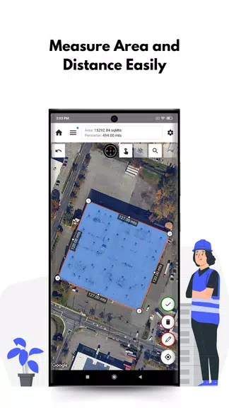
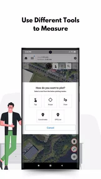
❤ All-in-One Measurement: Five powerful tools handle area, distance, and radius calculations, providing a complete measurement solution.
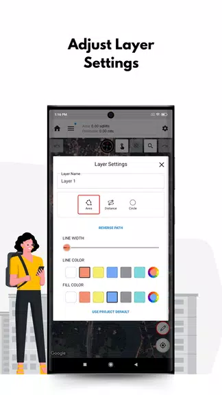
❤ Personalized Precision: Customize line width, color, and fill color for tailored measurements that meet your specific needs.
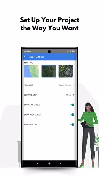
❤ Multiple Map Views: Choose from satellite, terrain, or street view map types for optimal visualization of your measurements.
❤ Real-Time GPS Tracking: GPS Live tracking provides real-time calculations as you move, ideal for dynamic measurement projects.
User Tips for Optimal Results:
❤ Layered Organization: Utilize multiple layers within a project to keep different measurements organized and easily distinguishable.
❤ Precise Location Pinpointing: Leverage the location search feature to quickly find specific locations for accurate measurements.
❤ Seamless Sharing & Export: Easily share your completed projects with colleagues or clients, and export your data for use on other devices.
In Conclusion:
Mapulator is a user-friendly and comprehensive measurement app perfect for professionals and hobbyists alike. Its powerful tools, customization options, and real-time tracking make accurate, on-the-go measurements simple. Download Mapulator now and streamline your measurement workflow!