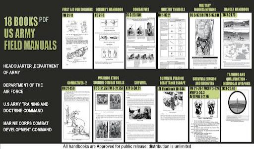
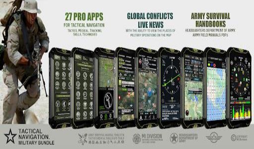
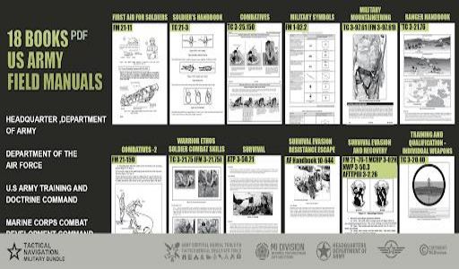
Features of Military GPS Survival Kit:
> Stamp Camera with Compass and GPS Info: This innovative feature lets you capture photos embedded with vital data such as GPS location, compass direction, altitude, and more. Add personalized notes and project names to your photos for enhanced documentation.
> Altimeter Distance Tracker: Monitor your altitude and distance traveled with ease. Select between imperial and metric units, and fine-tune the altitude for precise measurements.
> GPS Locations: Seamlessly obtain, save, and share map coordinates of your current location. Search for coordinates using addresses or building names, and access six different types of coordinate data.
> Heading Compass: Gain real-time orientation to magnetic fields with this comprehensive compass tool. It displays essential information including location, altitude, speed, magnetic field strength, and current weather conditions.
> Waypoint Navigation: Effortlessly add and navigate to GPS waypoints. Save multiple waypoints and follow directional arrows to your destinations, all without the need for a data connection.
> GPS Status Satellite Check: Evaluate the quality of your device's location data with this feature. It offers detailed satellite reports, coordinates, the number of available satellites, and satellite signal strength, helping you ensure accurate positioning.
Conclusion:
The Military GPS Survival Kit Bundle app is your ultimate companion for tactical expertise and outdoor navigation. Its comprehensive set of tools, including the stamp camera, altimeter, compass, waypoint navigation, and GPS status check, empowers you to track your position, plan your routes, and stay informed about global conflicts. Whether you're a seasoned military professional or an avid outdoor enthusiast, this app is essential for your adventures. [ttpp]Click to download now[yyxx] and unlock the full potential of tactical navigation!