Transform your phone into a powerful, offline GPS navigator using topographic maps! AlpineQuest, a comprehensive solution for all outdoor adventures, eliminates the need for cellular service. This app boasts no ads, data sharing, or third-party libraries, ensuring your privacy.
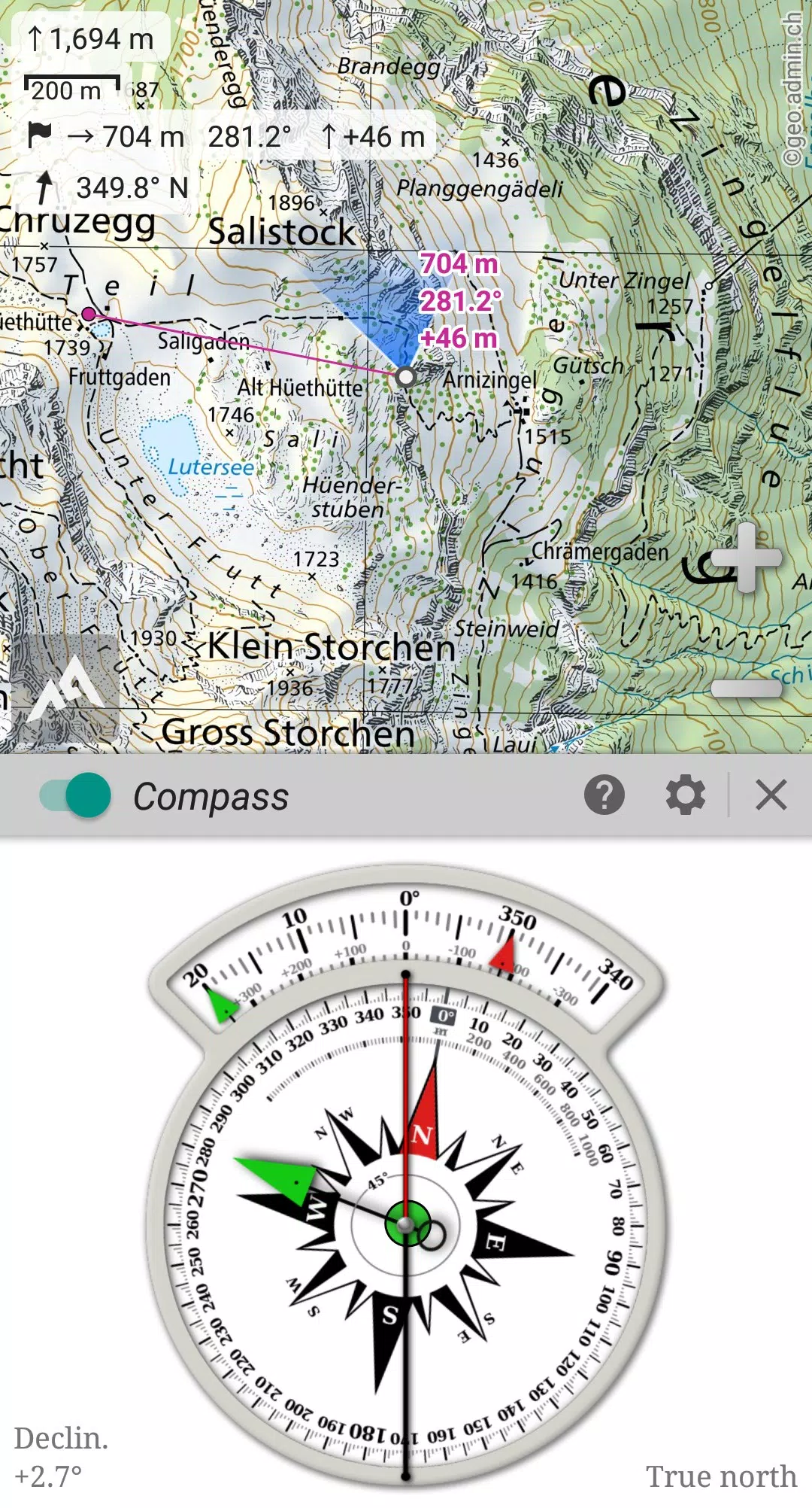
AlpineQuest supports a wide range of online topographic maps, stored locally for offline access. It also handles various onboard raster map formats. Using your device's GPS and magnetic sensor, real-time location and compass orientation are displayed directly on the map.
Create and share unlimited placemarks, track your routes, and generate detailed statistics and interactive graphics. AlpineQuest empowers you to explore even the most remote wilderness areas.
Download the free Lite version today! For suggestions or issues, please visit our forum: https://www.alpinequest.net/forum (no registration required).
Key Features (Full Version):
Maps:
- Integrated online maps (with automatic local storage; road, topo, and satellite maps included) and online layers (road names, hillshade, contours). Easily access additional maps from the community map list.
- Complete offline map storage for areas of interest.
- Extensive offline map support (raster), including KMZ Overlays, OziExplorer OZFx2, OZFx3 (partially), calibrated images, GeoTiff, GeoPackage, MbTile, SqliteDB, and TMS zipped tiles. (Use MOBAC, the free map creator, for compatibility).
- QuickChart Memory Map support (.qct maps only).
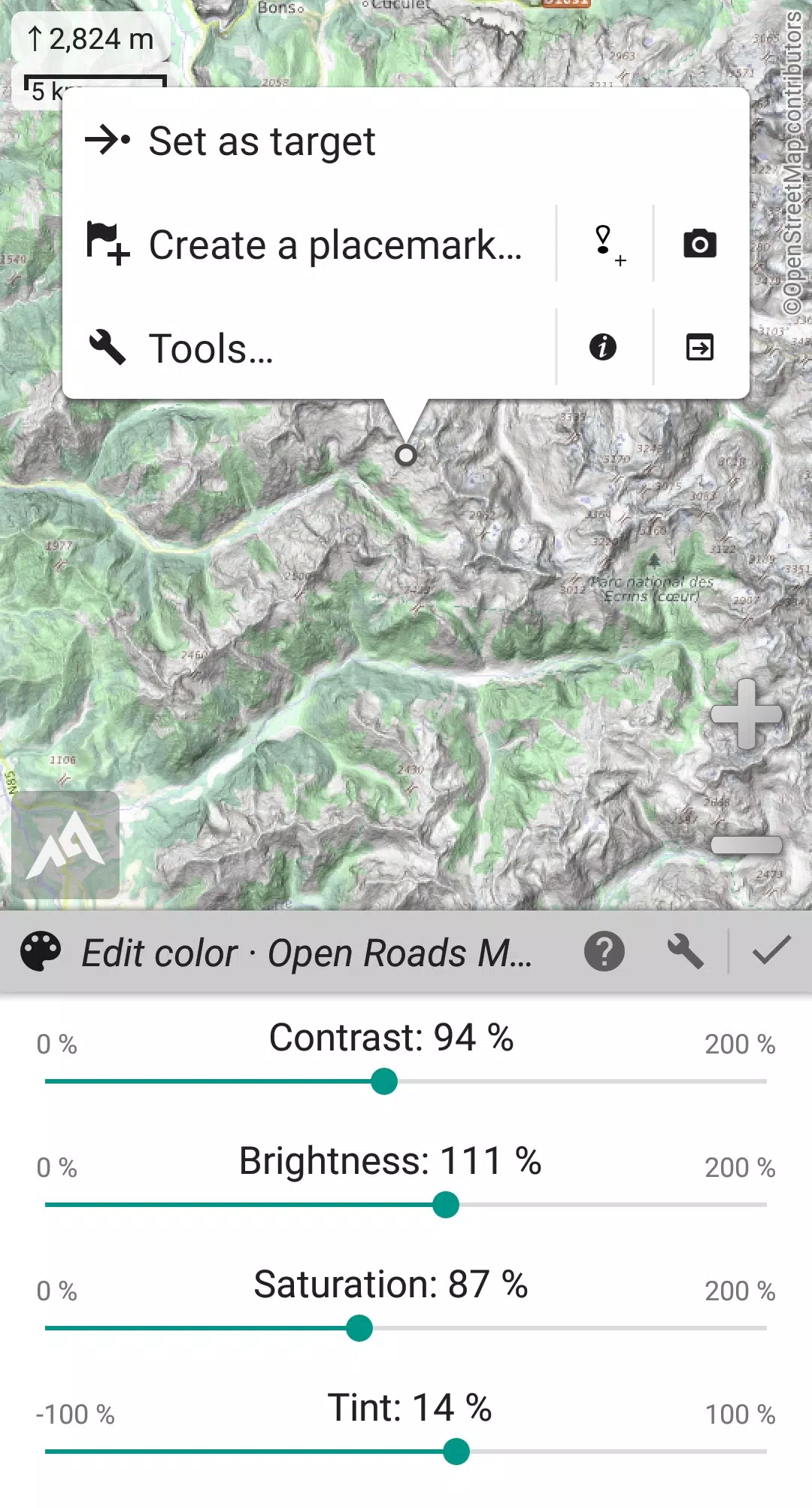
- Built-in image calibration tool.
- Digital elevation model (DEM) storage and support for HGT files, enabling terrain, hillshade, and steep slope displays.
- Polar map support.
- Multi-layered map display with customizable opacity, contrast, color, tint, and blending.
Placemarks:
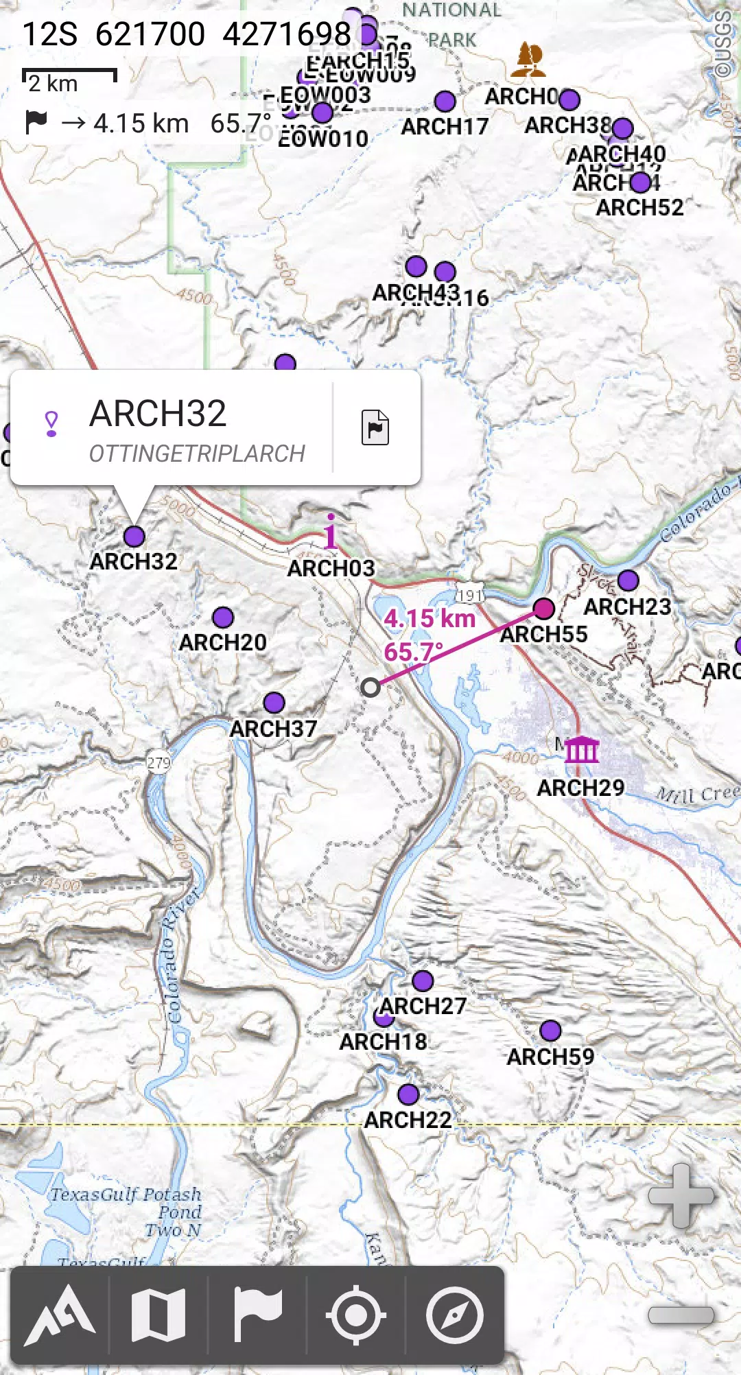
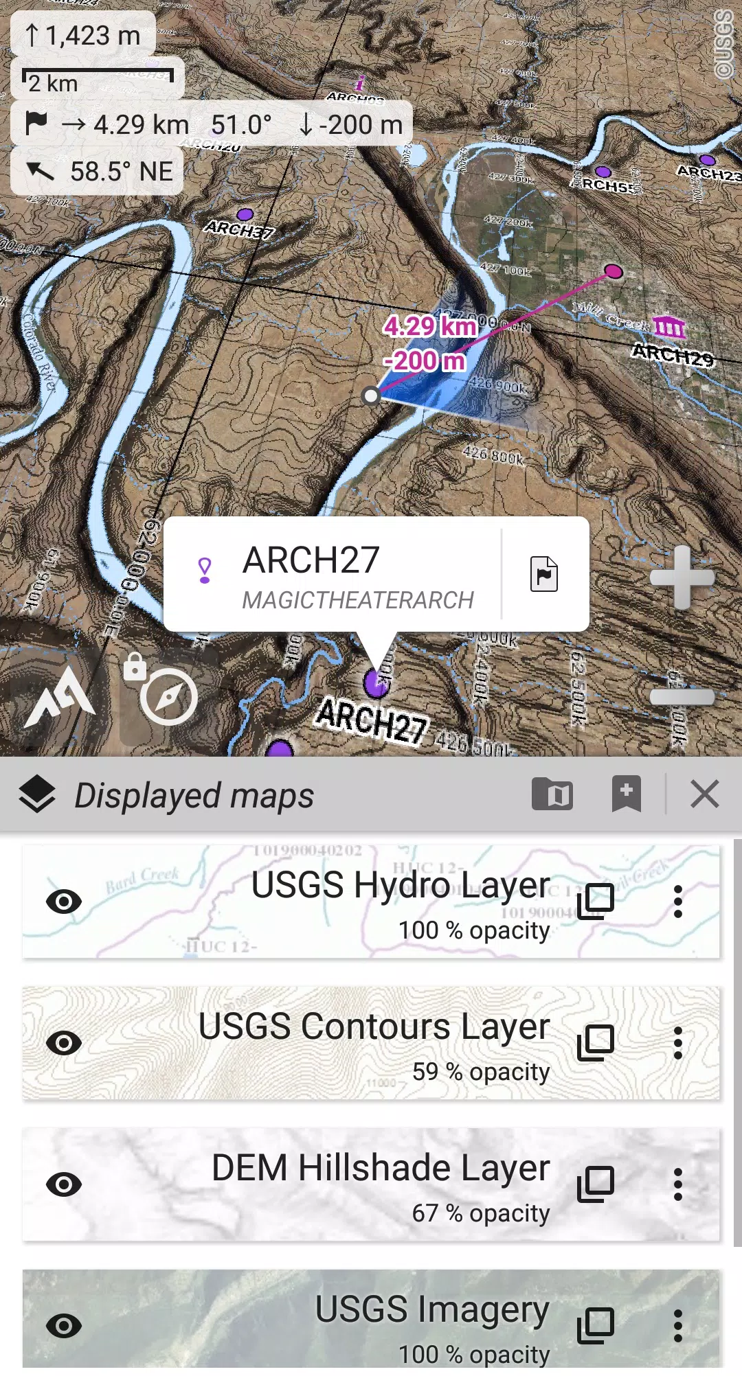
- Create, save, and restore unlimited waypoints, routes, areas, and tracks.
- Import/export GPX, KML/KMZ, and CSV/TSV files.
- Import/export ShapeFile, OziExplorer WPT/PLT, GeoJSON, IGC, and Geocaching LOC files; export to AutoCAD DXF.
- Share locations using Community Placemarks.
- Detailed statistics and interactive graphics.
- Time Controller for replaying time-tagged tracks.
GNSS Position/Orientation:
- On-map geolocation using GPS, GLONASS, Galileo, and network positioning.
- Map orientation, compass, and target finder.
- Built-in GNSS/barometric track recorder (long tracking) with battery and network strength logging.
- Proximity and leave-path alerts.
- Barometer support (compatible devices).
Additional Features:
- Multiple distance unit options.
- Various coordinate formats (WGS, UTM, MGRS, USNG, OSGB, SK42, Lambert, QTH, …) with on-map grids.
- Import support for hundreds of coordinate formats from spatialreference.org.
What's New in Version 2.3.8d (Aug 14, 2024)
- Customizable menu bar style and position.
- Improved Android compatibility.
- Enhanced backup and restore tools.
- New default URL for sharing coordinates.
- Customizable application "Media" folder for placemarks, icons, and maps.
- Added Croatian and Persian translations.
- Various bug fixes and improvements.